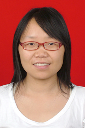
尹芳
尹芳,女,1983年5月出生,教授,博士生导师。博士毕业于中科院地理科学与资源研究所。主要承担地理信息系统、资源环境遥感、3S集成及应用方面的教学与科研工作。
电子邮箱:yinf@chd.edu.cn QQ:54385346

一、近年主持的主要科研项目情况:
重大专项“内蒙古中段金矿集区三维找矿预测与增储”项目之课题“高校勘查技术方法组合与找矿模型”专题三;2025.08-2030.08 主持
国家自然科学面上基金:基于GIS和LCA-MILP的陕西菊芋生物乙醇可持续性发展综合分析;2021.1-2024.12 主持
国家自然科学青年基金:基于GIS-LCA的陕西黄连木生物柴油能量生产及环境潜力研究;2016.1-2018.12 主持
合阳县自然资源局:合阳县2021重点乡村村庄规划;2021.10-2022.10 主持
青海省环境科学研究设计院有限公司:基于土壤污染多因素综合分析技术的湟水流域土壤污染物管控体系研究,2020.08-2021.11 主持
中央高校基本科研业务费高新技术研究培育项目资助:陕西能源植物黄连木规模化利用的温室气体减排潜力研究;2020.1-2021.12 主持
国家科技基础条件平台地球系统科学数据共享平台子课题:黄土高原地区社会经济统计数据处理;2015.9.1-2016.1.31 主持
二、近期主要科研成果:
[1]. Yin, F., Meng Wenrui, et al. Benefits of public awareness in mitigating cystic echinococcosis risk in western China: A climate and socio-economic perspective. PLOS Neglected Tropical Diseases,2025.
[2]. Zhang, Z., Yin, F.*, Zhu, Y. et al. Lithologic Mapping in the Karamaili Ophiolite–Mélange Belt in Xinjiang, China, with Machine Learning and Integration of SDGSAT-1 TIS, Landsat-8 OLI and ASTER-GDEM. Nat Resour Res, 2025. https://doi.org/10.1007/s11053-025-10467-0.
[3]. Han, Y.; Wang, B.; Yang, J.; Yin, F. *; He, L. Research on Hyperspectral Inversion of Soil Organic Carbon in Agricultural Fields of the Southern Shaanxi Mountain Area. Remote Sens, 2025, 17, 600. https://doi.org/10.3390/rs17040600
[4]. Luying Liu, Jingyi Yang, Fang Yin * and Linsen He. High-Resolution Mapping of Maize in Mountainous Terrain Using Machine Learning and Multi-Source Remote Sensing Data. Land, 2025, 14, 299. https://doi.org/10.3390/ land14020299.
[5]. Duan, S.; Yin, F*. Interaction Mechanism and Coupling Strategy of Higher Education and Innovation Capability in China Based on Interprovincial Panel Data from 2010 to 2022. Sustainability 2025, 17, 6797. https://doi.org/10.3390/su17156797.
[6]. Tariq Ashraf, Fang Yin*, et al. Land Subsidence Detection Using SBAS- and Stacking-InSAR with Zonal Statistics and Topographic Correlations in Lakhra Coal Mines, Pakistan, Remote Sensing, 2024, 16, 3815.
[7]. Liang, Q.; Yin, F. Quantitative Analysis of Agricultural Carbon Emissions and Absorption from Agricultural Land Resources in Shaanxi Province from 2010 to 2022. Sustainability 2024, 16, 8170. https://doi.org/10.3390/su16188170.
[8]. Liang, Q.; Yin, F. Measurement and Evaluation of the Modernization Development Level of Higher Education in China: Based on Panel Data Analysis of 31 Provinces from 2012 to 2022. Sustainability 2024, 16, 7250. https://doi.org/10.3390/su16177250.
[9]. Fang Yin, Wenrui Meng, Lei Liu, Kai Feng and Cuijing Yin. Spatial Distribution and Associated Risk Assessment of Heavy Metal Pollution in Farmland Soil Surrounding the Ganhe Industrial Park in Qinghai Province, China. Land 2023, 12, 1172. https://doi.org/10.3390/land12061172.
[10]. Liang, Q.; Yin, F. Empirical Study on the Relationship between Leader–Member Exchange, Employee Trust, and Team Knowledge Sharing. Sustainability 2024, 16, 8057. https://doi.org/10.3390/su16188057.
[11]. Yongchun Liang, Fang Yin*, et al. Inversion and Monitoring of the TP Concentration in Taihu Lake Using the Landsat-8 and Sentinel-2 Images. Remote Sensing, 2022.14, 6284.
[12]. Danyun Zhao, Fang Yin*, et al. Estimation of Pb Content Using Reflectance Spectroscopy in Farmland Soil near Metal Mines, Central China. Remote Sensing, 2022, 14, 2420.
[13]. Danyun Zhao, Fang Yin*, et al. Evaluation of Marginal Land Potential and Analysis of Environmental Variables of Jerusalem Artichoke in Shaanxi Province, China. Frontiers in Environmental Science,2022,10:837947.
[14]. Fang Yin, Mengmeng Wu, et al. Predicting the abundance of copper in soil using reflectance spectroscopy and GF5 hyperspectral imagery. International Journal of Applied Earth Observations and Geoinformation, 2021, 102, 102420.
[15]. Fang Yin, Ziyue Jin, et al.Spatial Assessment of Jerusalem Artichoke’s Potential as an Energy Crop in the Marginal Land of the Shaanxi Province, China. Sustainability, 2021, 13, 13576.
[16]. Fang Yin, Xuefei Yang, et al. Evaluation of the potential land for biofuel plant development in the Shaanxi Province, China. Geological Journal, 2018, 53, S1(332-341).
[17]. 李贞演,高振记,尹芳*,等.陕北典型煤矿区SDGSAT-1数据地表温度反演及煤火监测.遥感技术与应用,2025(网络发表).
[18]. 刘靖宇,尹芳*,等.荒漠绿洲区土壤生态化学计量特征及驱动因素.中国环境科学,2024,44(01):300-309.
[19]. 尹芳,朱家政,孟文睿,等.基于MaxEnt模型的陕西省菊芋种植潜在适宜区分析.中国农业气象,2024,45(03):268-280.
[20]. 尹芳,封凯,尹翠景,等. 青海典型工业区耕地土壤重金属评价及源解析.中国环境科学, 2021, 41(11): 5217-5226.
[21]. 尹芳,封凯,吴朦朦,等. 一种基于分段偏最小二乘模型的土壤重金属遥感反演方法. 遥感技术与应用, 2021, 36(6): 1321-1328.
[22]. 梁永春,尹芳,赵英芬,等.基于Landsat 8影像的太湖生化需氧量遥感反演[J].生态环境学报,2021,30(07):1492-1502.

